|
Hold on While Loading Virtual Maps and routing ride # 416 | |||||||
|
|
Comment/Story/Advice: 2008-08-02 17:33:26 Shai
from Encino, CA:
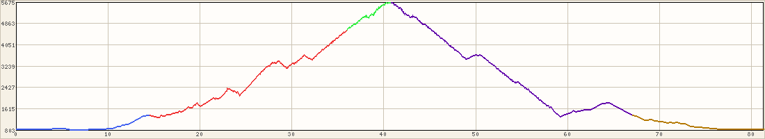
The elevation gain is way off. This ride is about 6,400ft. But you do 80-90% of these in 40 miles, so it feel like 7+k. While the route have 4 stops (rest stops) we usually doing even more with the regroups stops. 2009-12-12 23:27:06 Dan
from LA (san fernando valley), CA:
That graph above tells it all Post a Comment for ride #416; Level 5; 82.2 miles
| ||||||||||||


, Christy Bonnett")

, Evan Grissom, Lee, Michael Goodman, Peter Glenn, Randy Lawrence")
")
")


